Monday, March 21, 2011

Scenic Matsushima Bay -- before and after

Scenic view of Matsushima. Ukiyo-e woodblock print by Yōshū Chikanobu, 1898

(from Wikipedia): Matsushima (松島) is a group of islands in Miyagi Prefecture, Japan. There are some 260 tiny islands (shima) covered in pines (matsu) – hence the name – and is ranked as one of the Three Views of Japan. The Three Views of Japan (日本三景 Nihon Sankei) is the canonical list of Japan's most famous sights, somewhat akin to the Seven Wonders of the Ancient World. The list is usually attributed to scholar Hayashi Razan, who first listed them in 1643.

The news is not too bad for Matsushima Bay, although it's been hard to find any news. The bay is at the north end of the Sendai plain so somewhat protected, and it's on a terrace [see photos]. So compared to towns farther north, they are relatively ok. Yesterday I found the website for the town of Matsushima up and reporting to its citizens what was working and what was not, where they could get help, and so on. The 6 deaths reported were sick people who were already in the hospital. In a sign of normalcy, garbage pickup is proceeding. . The website is in Japanese, but I could get the gist of it from my Google Chrome auto-translator. http://www.town.matsushima.miyagi.jp/

Above: view of Matsushima Bay. Photographer: Kumamishi [via wiki commons]

So it's time for me to start my tour of the towns we visited last April on a trip to see how these towns had prepared for tsunamis. It will become more painful as we move north. Below on the left is the map of the stops we made on this two-day trip; Matsushima is just north of Sendai, in an embayment. On the map on the right, Matsushima is just north of the 80-km radius of evacuation recommended by the U.S. as we wait for the situation at Fukushima to be resolved, last April, we left Sendai in the morning, and Matsushima Bay was our first stop.


It was a gray misty rain when we visited Matsushima Bay, and I didn't take very many pictures. Because it is a MAJOR tourist destination, the town must pay particular attention there to making clear to non-locals what to do in case of a tsunami alarm, such as this evacuation arrow on the sidewalk. I noted many tour boats, some of them very large, but have only the photo of smaller ones below.


The picture on the left above is one I took in April 2010. The one on the right was taken after the tsunami by Meshikui from Sendai – http://p.twipple.jp/chxUC. This is the parking lot where we parked our bus; looks like now it's covered with a tsunami deposit of sand. How did I find this photo? Googling around, I ended up on "Yahoo answers" via someone's question "Did Matsushima Bay get hit hard by the tsunami?" The question was asked by someone looking for a friend. One of the three answers led me to Meshikui's pictures.

Today, 21 March 2011, is a national holiday in Japan, described as a day to appreciate beauty and living things. Amidst my despair at the destruction on this coastline, I try to be thankful that Matsushima Bay, one of the Three Views of Japan, was spared from major damage.

(from Wikipedia): A well-known apocryphal haiku often attributed to Matsuo Bashō indicates that the poet is at a loss for words:

Matsushima ah!
A-ah, Matsushima, ah!
Matsushima, ah!

From the Matsushima website accessed 20 March 2011, auto-translated:
Information with the Great Kanto Earthquake - Kita Azuma;
Matsu Shima work hard!

We sincere sympathy to everyone affected by the Great Kanto Earthquake occurred on March 11, NE.
At present, such as town water and food supplies, we're working around the clock to assist everyone was evacuated.
As soon as possible, to restore the lives of normal, citizens do our best to work together to overcome this difficulty.

Sunday, March 20, 2011

Post-Tsunami Science II --Hokkaido University Institute of Seismology & Volcanology

This is a party at my flat three weeks ago during the visit of Latief, Fujii and Kenji Satake (ERI, Tokyo; photographer). Around the circle from left: Jody Bourgeois, Yuichiro Tanioka, Kei Ioki, Takuji Yamada, Hamzah Latief (ITB, Bandung), Adit Gusman, Yugo Nakamura, Yushiro Fujii (BRI, Tokyo)

HOKKAIDO UNIVERSITY IN SAPPORO (Hokudai)

I can write a bit more expansively here, because it’s where I’ve been based this winter. Some of my blogs in January talk about and show pictures of Hokudai and its city of Sapporo. Something I saw the other day, but didn’t have my camera to capture—a rally of the Hokudai American football team (since 1976), called “Big Green,” all suited up and yelling so you could hear it halfway across campus.

http://www.sci.hokudai.ac.jp/isv/english/

The institute is focused on the geophysical study of volcanoes, earthquakes and tsunamis. From their website: We install many observation systems such as seismometers, tilt-meters, strain-meters, GPS, tide gauges, etc, in and around Hokkaido. We also carry out campaign surveys using various geophysical instruments in summer time every year. Students who are interested in large earthquakes, volcanic eruptions, or tsunamis, and like to use geophysical instruments in the field are welcome to join us.

Left: late Friday evening, 11 March 2011,

Prof. Emeritus, Minoru Kasahara and Professor Muroto Murakami discuss the possibility that the Jogan events of 869 A.D. are the predecessors to the 11 March 2011 earthquake and tsunami that had been triggered earlier on this day.


Yuichiro Tanioka, Director, ISV

Tanioka is a leading tsunami seismologist. One of his primary foci is the understanding of relationships between earthquake rupture and tsunamigenesis and propagation, in particular using records from tide gages and deep-water buoys. See more below in entry for his post-doc Adit Gusman. Because Yuichiro is Director of the Institute, a big part of his job is to ensure that the researchers in the Institute can all carry out their work. He also acts as a liaison with other institutions as well as with the public. This winter one of his roles, for example, was to be part of an expert panel to analyze damage done to harbors on Hokkaido from the 2010 Chile tsunami. Now look what they have to deal with!

Yuichiro is my official host here, as well as a gracious personal host, and he has been kind enough to take me skiing and also to a Hokkaido Nippon Ham Fighters [pre-season] baseball game in the Sapporo Dome. Friday we had lunch for the first time since before 11 March [usually a group of us has lunch together every day], and he told me a bit about what’s happening, for example:

The seismographs in the affected region on Honshu were all knocked out, and other universities and agencies are trying to put the network back together. This is important to measure all the aftershocks and other related earthquakes that are happening since the big one. Access was hard enough, but the nuclear situation has actually stopped some activity and access entirely. Also, a ship is ready to deploy ocean-bottom seismometers and do other surveying, but it cannot go to sea without clearance vis a vis the potential radioactive fallout. There was a 6.4 earthquake under Fuji not long after the big one offshore, the volcanic seismologists are looking into that; this institution is one that does volcano monitoring.

Also, ISV is making sure their own systems are working well and backed up, because if there is an earthquake on (or offshore) Hokkaido, the help they would normally get from other institutions is not likely to materialize. The big one has loaded nearby faults with additional strain, so earthquakes are more likely to occur in the near future --near being anything from the next week/month to the next few years, or more.

Since the events of 11 March, Yuichiro has also had to communicate a lot with the media – on a typical day he does not wear a suit, but he’s been dressed up all this week. Oh, and this afternoon (Sunday), the institute is sponsoring an informational session for the public about the earthquake and tsunami. Tomorrow is a public holiday, but it will be no holiday for scientists on the front line.


Yuichi Nishimura

Nishimura-san is the investigator here whose current work is most closely related to the kind of work I do—tsunami deposits. He came to our workshop in Seattle in 2005, and then he took me and my students out in the field here in Sapporo for a day in 2006 when I was here for a conference. For some part of the time I’ve been in Sapporo this winter, Yuichi has been in Indonesia surveying deposits from the October 2010 Mentawai tsunami. His geological and geophysical expertise is wide-ranging, and he also is head of the Hokkaido rugby league. And he designed the new logo for the institute --he pointed out to me that it includes layers.

Last Friday night as the tsunami was beginning to arrive on Japan’s coastline, already Yuichi was preparing to go to the field to survey the effects and runup of the Tohoku tsunami on the Hokkaido coast. He left Saturday morning 12 March and returned 18 March, when he was kind enough to take a little time to show me on a map where he went, and to describe how people evacuated successfully (the one fatality a very drunk man, he said), and what the runups were. I look forward to seeing his photographs and report (I’ve offered to help edit English version, a tiny help I can be). The tsunami hit the southern and eastern coasts, particularly, did significant damage in two harbors, and had runups of mostly 3-4 m, the maximum 5-6 m. In case you are thinking that’s small – look up at your ceiling, which is probably about 3 m, and imagine it’s all water up to there.

Nishimura-san has been absent from his office every time I come to take a picture. So far, I have him from our 2006 field trip; in this photo above, the elusive Yuichi is under the baseball cap.


Jun’ichi Miyamura

Miyamura-san is “on loan” from Japan’s Meteorological Agency (JMA) – the NOAA of Japan. He is part of the Scientific Support Section of Hazard Mitigation for Earthquakes and Volcanoes at Hokkaido University. His focus is on education, outreach, and preparedness for natural disasters. His office is open to the room with the big TV screen where we watched the tsunami roll in. That afternoon of the earthquake and tsunami, he tried to watch with us, but his phone was ringing off the hook. Most days when I walk up to the third floor, arriving at work, Jun'ichi is usually already at his desk, and I say "ohaio gozaimas," but the other morning when I arrived, Miyamura-san was out shoveling the snow at the entrance of the institute, so I said "arigato gozaimas."


Takuji Yamada

Takuji is part of our regular lunch bunch and has an outgoing personality. He was a JSPS post-doc at the USGS Hawaii Volcano Observatory for a couple years.

His main research interest is the physics of earthquake source, including rupture speed, stress drop of earthquake, and heterogeneity of slip distribution, that is, strength and dynamic stress level on the fault.

He also has delved into the geophysics of volcanoes, and is involved in observational seismology in general, including in a gold mine in South Africa. I recently caught him outside the building in a group checking out instruments for a deployment. He's the one in the green sweater.


Adit Gusman

Adit recently got his Ph.D. at Hokudai and is now a post-doc at the IVS. He is from Indonesia and represents a major cooperative agreement between Japan and Indonesia for research and education in tsunami science and mitigation. Adit has been modeling tsunamis and their generating earthquakes, based on tide-gage records of the tsunamis. He also is interested in modeling tsunami sediment transport. Since I’ve been here, he and I have been working on reconstructing the 1997 Kronotsky earthquake and tsunami on Kamchatka, but since 11 March 2011, he is of course caught up in these recent events. What an opportune time to be a young tsunami scientist. However, as we all are, Adit is sobered by this giant earthquake and tsunami. Adit and I are friends on Facebook, but most of the posts on his page are in Indonesian, so I get the pictures, but not the words.

To the right is Adit's model of rupture of the 11 March earthuquake based on inversion of tide-gage records -- this is fast work!


Yugo Nakamura

Yugo Nakamura is a post-doc working most directly with Yuichi Nishimura. He gave a talk in our group seminar, early on in my visit, about trying to determine methods for correlating a tsunami deposit from one site to another, testing various methods such as grain-size distribution and microfossil content. This is excruciatingly detailed work, as science commonly is. Yugo appears to be the resident connoisseur of wine from rice and grapes. At our last party, he brought both sake and some local Hokkaido wine. It’s hard for me to shop for these items, not being able to read labels, and particularly, knowing zilch about sake.

Since the earthquake and tsunami, Yugo has been out surveying the coast of Hokkaido. I haven’t seen him since the night of Friday 11 March.
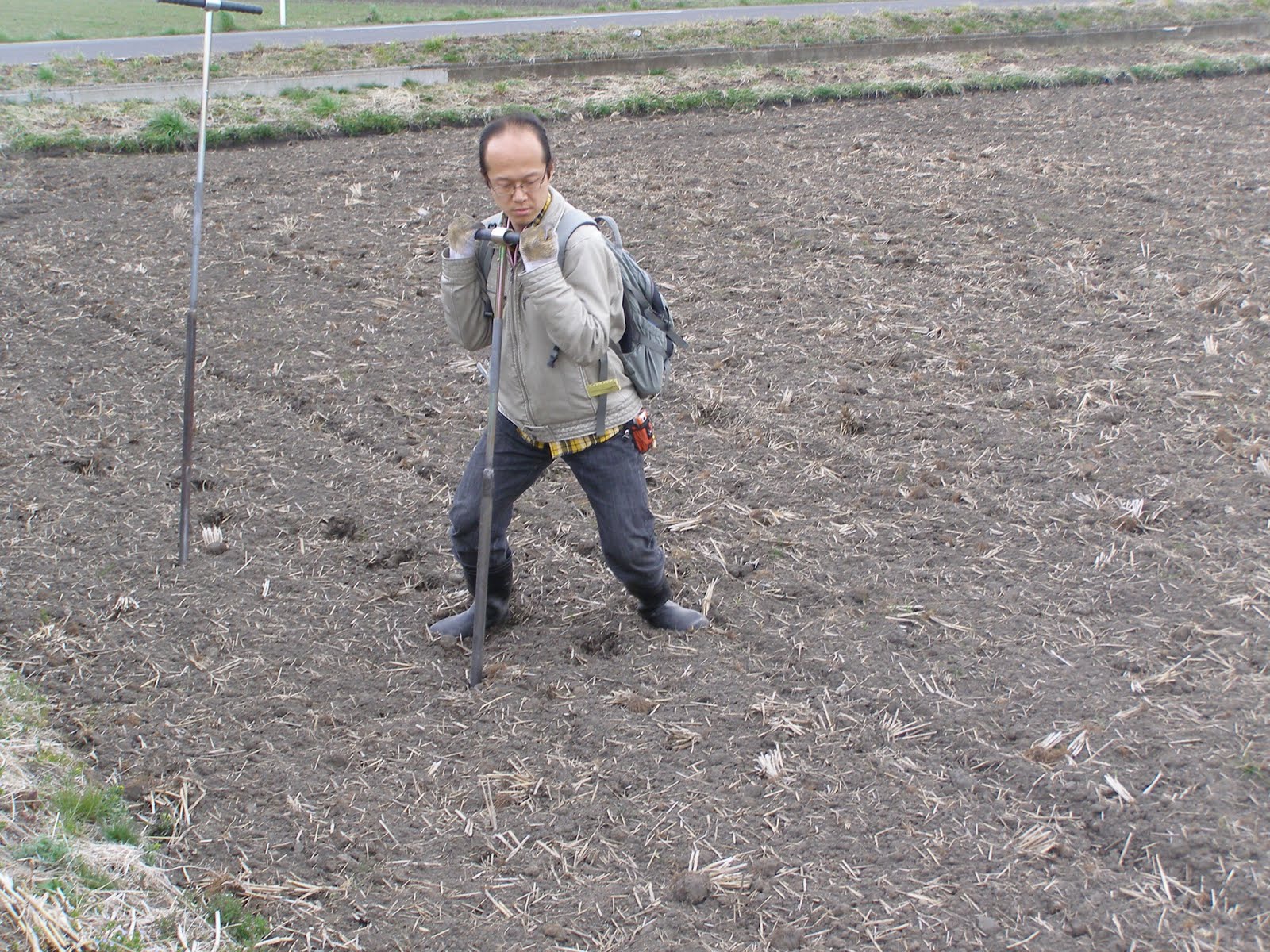

Kei Ioki

Kei is one of a number of graduate students in the Institute, she is doing tsunami modeling and participates on our tsunami seminar, where she gave a talk about her modeling of tsunamis in the Hokkaido-Kurils region.

Photography by Victor Kaistrenko, who was visiting from Sakhalin.


Evening of 11 March 2011 -- this is only the beginning of what will be an all-nighter for most researchers at the Institute of Seismology and Volcanology at Hokkaido University. This night, Yuichiro Tanioka and Adit Gusman were stuck in Tokyo, where they had been for meetings on the day of the giant earthquake.

Saturday, March 19, 2011

Post-tsunami science in Japan -- Part 1

Post-tsunami science in Japan -- Part 1 -- Shuto-sensei and Tohoku University

This is a picture of our field trip group and our hosts in Kesennuma City, April 2010; our hosts are in suits, whereas we had come directly from the field. Later, we will learn more about the fates of these fine citizens of Kesennuma, one of the towns which was devastated by the tsunami. Shuto, his wife, and Imamura are front and center. Photo courtesy Helmut Brueckner

Some people have been asking me, what are Japanese scientists doing now?

I am writing below only about some of the people I know. There are many many more researchers now trying their best to keep up with science while also dealing with the human tragedy and ongoing risks. And the well-being of their own families and friends. The recent information comes primarily from postings to bulletin boards, not direct communication to me. You can link to much of this information here: http://www.coastal.jp/tsunami2011/

[names are written English-style, surname/family name second]


Nobuo Shuto

Formerly in Faculty of Policy Studies, Iwate Prefectural University

(Iwate is one of the prefectures heavily hit, in northern Honshu)

Recently at: Advanced Research Institute for Sciences and Humanities, Nihon University, Tokyo

and: Disaster Control Research Center, Tohoku University [see below]

I call Nobuo Shuto the “super-sensei” of tsunami science. He is one of the pioneers of tsunami modeling and now is particularly focused on tsunami hazard planning. Last year I had a chance to ask him how he got started in the field, and he said he was a graduate student when the Chile 1960 tsunami struck Japan, he went out on survey, and that determined and defined his career. The Pacific coast of northern Honshu is a place he has returned to again and again in his studies, and last April, he co-led our field trip there. He is a wealth of knowledge about the science and history of tsunamis on this coast, and he knows the people well.

Since 11 March 2011 he has posted some messages about the well-being of people we met, the historical catalogue of the region, and about conditions locally in the heavily affected region. His messages also mention the bad weather. Update 22 March in Japan: Today Shuto-sensei posted some more of the historical information about tsunamis in this region, ending with this note:

"As for the Meiji one, I can not find the original report because of a big mess in my library."

I found this picture (above, left) on the web of Shuto-sensei when he visited Crescent City, CA a few years ago. I believe Lori Dengler is the photographer.


TOHOKU UNIVERSITY IN SENDAI

The university in Sendai was severely damaged. From Koshimura-san: The laboratory was completely destroyed, and everything is inoperative. Servers were also destroyed. Electrical power is available only in the first floor of the Sougou-Kenkyu Building, where our activities are presently being conducted.

The Tohoku group is a leader in tsunami research, including tsunami engineering. They hosted the workshop I attended last April: Tsunami: Science, Technology, and Disaster Mitigation. We have received word that they and their families are ok, but this must be a terrible time for them.

Fumihiko Imamura

Director, Disaster Control Research Center Tsunami Engineering Laboratory

Working website: http://www.dcrc.tohoku.ac.jp/english/organization/tsunami.html

Fumi has been working for decades on tsunami engineering and science, with work in surveying, modeling and sedimentology. From Wikipedia!: " His current research encompasses numerical tsunami simulation, warning systems, disaster prevention and evacuation." I first met him in 1992 on the Nicaragua post-tsunami survey. Last spring he was lead organizer of the 3rd International Tsunami Field Symposium at Tohoku University [their website is down, server destroyed at Tohoku], and he co-led the trip following the meeting to the Sanriku coast. He was part of a study of the Jogan tsunami deposit, now considered the predecessor of the 2011 Tohoku event.

I haven’t heard directly from Fumi but know he is actively trying to study this event, reflect on the evidence from the AD 869 Jogan event, and keep his life together in devastated Sendai. He must be incredibly busy, as director of his institute. (see note at the end of this post)

The picture (right) is of Fumi-san (brown coat) telling us about the tsunami gate in Minami-Sanriku on our April 2010 field trip.


Koji Minoura, Department of Paleontology

Minoura-san is one of the pioneers of tsunami geology. I first met him in 1995 at a tsunami workshop on Kamchatka, where already he had done field work.

Minoura-san has written: The laboratory and my home are in terrible shape. It will take a long time to clean up. Commodities such as gasoline are extremely short. The fuel is being reserved for emergency vehicles, so I cannot refuel my car. The coastal area cannot be accessed because of rescue operations and heaps of debris. Also, thick, waist-high sludge covers some places, which are too dangerous to enter.

Minoura-san was lead author of a study published in 2001 on the tsunami deposit from the A.D. 869 Jogan event, now widely considered to be the predecessor to the 2011 earthquake and tsunami. In that study, Minoura and colleagues also found evidence for two older very-large tsunamis, with an average recurrence interval of about 1000 years. Based on modeling by Imamura and others, they estimated the Jogan to have been an 8.3 locally. But in highsight and with more work done and to come, it could be that this same deposit is present along more of the coastline (e.g., to the north) and the earthquake was larger in total moment.

The picture is from our field trip last April to Ishigaki Island to see tsunami boulders.


Shiyunichi (Shunichi) Koshimura

In the world of small worlds, Koshi lived in my house in Seattle for the year 2000-2001 while I was on sabbatical in Russia (Kamchatka). I didn't meet him at that time for awhile, but remember writing to him after the 2001 Nisqually quake hit the Puget Sound region, to ask him how was my house. He wrote back that he was in Hawaii, but reports were that my house was fine.

Dr. Koshimura is part of the DCRC, whose primary objectives are:

  1. Millennium Tsunami disaster risk evaluation –fusion with sedimentary information
  2. Development of high precision Tsunami risk evaluation (Direct and indirect methods of evaluation and estimation)
  3. Comprehensive research for mitigation of Tsunami disasters in and out of Japan
  4. Introducing Tsunami warning system to regional residents (Simulation and Real time observation data)

Koshimura-san tried to conduct a post-tsunami survey on the Sendai plain, 12-13 March but had to turn back. A short report: The area between the southern bank of the Natori River and the northern part of Sendai Airport was surveyed. This area is a flat plain, and the tsunami invaded it through an underpass of the Sendai-Tobu Road. The tsunami reached 3 to 4 km inland. The plain was still flooded by muddy water, with the depth being about 1 meter at approximately 3 km from the coast (the only measurement made in this survey). Approaching the coast through this water is impossible.

Photo (left) by Koshimua, Sugawara holding rod.

Daisuke Sugawara

Sugawara-san is also a tsunami sedimentologist and micropaleontologist,with studies ranging from co-investigations of the 896 Jogan event, to deposits from the 2004 Indian Ocean. I first “met” Daisuke with many e-mail exchange via his role as coordinator for the 2010 tsunami symposium at Tohoku University I found his name easy to remember because of the famous Japanese pitcher now in US major leagues, Daisuke Matsuzaka -- “dice-k”

Sugawara-san was the one who led our field trip to the Sendai plains, to see the deposits of the Jogan tsunami. He also was on the team that recently tried to survey the effects of the 2011 Tohoku tsunami on the Sendai plain. He is working with Koshimura on post-tsunami effects. The microorganisms preserved in tsunami deposits can help us understand where the tsunami water came from, and where the tsunami eroded the offshore.

Here (right) he is demonstrating coring on the Sendai plain.


FLASH--A report via e-mail on Saturday 19 March from Megumi Sugimoto (she studies Disaster Relief and Recovery, based at Earthquake Research Institute in Tokyo--more on her group in another post), of the situation at Tohoku University in Sendai:
Occasionally I saw Prof. Imamura on the street without appointment today.
I was eager to see him after the disaster.
I try to make sure hope for tsunami mitigation again after such disaster.
He was a hero for tsunami DRR in Japan.
He looked ok however was shocked.
His staff who showed us field practices by geoslicers last ITFS was
also shocked very much.
I couldn't say good words to them.

Friday, March 18, 2011

Heart and Mind

Minami-Sanriku before

Saturday 19 March 2011

On the NPR website (which soon may lose federal support…?), I read an eloquent essay by astronomer and science commentator Adam Frank, who was reflecting on an e-mail from Pete J. of Australia, which said in part,


“Somehow the science of it all has suddenly lost its appeal.”

Adam Frank reflected:

“....I was deeply struck by Pete's reaction. One of the comforts of science's vision is an understanding that the world has its own path. The cosmos and the planet have their own movements whose focus does not rest with us. Those movements can include the path of storm clouds, whether we pray for rain or not. They can also include the abrupt tear of tectonic plates slipping 400 meters to release energies we can scarcely imagine….

….But at some point we crash up against domains where science, or at least science alone, cannot help. In those moments, when we are numb with the immediacy of great suffering, explanations can become clay on the tongue."

http://www.npr.org/blogs/13.7/2011/03/16/134549260/in-tragedy-and-suffering-when-science-loses-its-appeal

When I read this essay a few days ago, I really felt it expressed some of my current feelings with regard to the conflict between my involvement in the science of tsunamis and the devastation we have once again seen in Japan. For more than a decade after we started working on tsunami geology in the later 1980s, there were many “small” events which were locally devastating, and each time one happened, my human heart and my scientific mind were both very engaged. Then 2004 Boxing Day event occurred in the Indian Ocean, and the scale of devastation and misery was overwhelming. I didn’t want to be a tsunami scientist, somehow I felt guilt by association.

Now here in Sapporo, not far from the devastation, I go up and down. Sometimes my feelings draw me away from the science to find a poem or a photo or a sketch of something beautiful and calming and consoling. Then I come back to thinking about the science and looking for data, reading scientific reports, even thinking of possible future research on what’s happened here. Then I come face-to-face with a picture or story that’s heartbreaking.

Yesterday I was working on a blog entry about what Japanese scientists are trying to do right now, after and about the earthquake and tsunami. I was also starting to prepare a blog about the towns we visited last April on a tsunami field trip—towns where we were so graciously hosted, where we were educated about how they prepared for tsunamis (lessons we could take home to our own countries), and where now there is overwhelming devastation.

Some before and after on-the-ground images here:

http://www.news.com.au/world/minami-sanriku-the-town-that-disappeared-as-it-was-before-the-disaster/story-e6frfkyi-1226022577064

Minami-Sanriku after

I am starting to put together my own photographs from that trip with the images that have emerged since last Friday. I am beginning to be able to look at these images and on-the-ground ones like those on the web entry above, but it hurts.

And then... I see something like evidence of tsunami erosion in before-and-after photos, and my mind comes back to the science. I see a picture I took of a vertical evacuation structure in Minami Sanriku (the town that is no more) and then the “after” picture where it is still standing – it was four stories and it survived as a building – did it save lives, was it tall enough?

From another town we visited, Kesennuma City (indeed they showed us their museum, held a public lecture, hosted us a banquet/reception; and we stayed at a waterfront hotel, where some of us danced and sang karaoke into that April night), here is a poignant story:

http://www.slate.com/id/2288248/

This morning I have been feeling reflective and I went back to Adam Frank’s essay. It still says so much of what I feel. But… this time I got caught by this sentence:

They can also include the abrupt tear of tectonic plates slipping 400 meters to release energies we can scarcely imagine….

… and the scientist came back in me – I know of no case, including the very largest event, Chile 1960, that had slip of more than 10s of meters. The big energy comes from the length of the ruptures (100s of kilometers), not the slip, though the slip is indeed large – now measured on land at more than 10 meters and modeled offshore in places to be at least 20 meters on part of the 2011 Tohoku rupture. Such a rupture is HUGE, though it doesn’t sound like much, maybe, to the lay reader. This sentence in Adam’s essay made me want to start looking at references to see if I am mistaken somehow...

It won’t matter at all to most of his readers if it is a mistake. Indeed, it seems silly for it to matter even for me, but now it’s not so easy to read the essay as I want to -- to help my heart and to help integrate my scientific and feeling selves -- they don’t really live in different compartments. Except when they do.

Thursday, March 17, 2011

How can we help?

People ask me how they can help. Right now, most help we can give is remotely--even for me in Japan. This is a link to a list of organizations, vetted by the University of Washington, who can accept your donations, but please consider not earmarking your donation, e.g., to a large agency which may well be able to use the money elsewhere when Japan's needs are met.
http://www.washington.edu/news/articles/japans-disasters-ways-that-you-can-help

If I come across more specific ways people can help, I will let you know. For one small example, we in the tsunami-science community have been organizing some people who can help translate and edit updates and information from our over-worked colleagues here in Japan.

Right now, I am aware that one of the best things I can do for these Japanese colleagues is to deflect unnecessary contacts with them. This includes me not bothering them, too. If you have specific questions about the tsunami and its predecessors and aftermath, I can try to answer them here [and see prior posts] or direct you to the many experts who can. Here is a list of University of Washington experts who can answer questions -- despite the title, it's been updated and now also includes experts on nuclear engineering:
http://www.washington.edu/news/uw-earthquake-tsunami-experts

I am ok -- and Hokkaido is not Honshu

18 March AM Japan time

In the last couple days, it has become clear to me that many people, including Japanese, when they say "Japan" basically mean "Honshu." Let me try to put this into perspective without more maps, because I don't have time to play with making and uploading more images at the moment. Look at any map of Japan, compare it to California. Japan is a VERY long country [more like Baja to Washington State], a tectonically active archipelago, or "island arc" as we say in geologic lingo. Hokkaido was only relatively recently settled by Japanese -- it's part of the original land of the Ainu. It's a large island much less densely populated than Honshu, which is the largest and most developed island in Japan's long chain. Thus people tend to say "Japan" when they mean "Honshu."

Imagine there is a crisis in a nuclear facility south of Los Angeles. Would we be calling on the city of San Francisco to evacuate? When the US advises its citizens to leave, how far should they go? Should I evacuate? It's true that my leaving Japan (scheduled for 31 March) may become logistically more difficult, depending on how things go, but I have a ticket for that day, Sapporo-Osaka-San Francisco-Seattle, not even going through Tokyo. Seems good to me. Otherwise I'd be better off taking a boat to Sakhalin. Or just staying put. This is not in any way heroism or false heroism on my part (I am not playing the part of the Harry Truman of Mt. St. Helens days). It's just fine here, I have things to do, why should I take that time to pack up and leave?

Last night I walked home with my young friend Olga--she says Russia, especially the Far East, is freaking out, it appears, and her family is trying to get her home. She says she made a map for them comparing how far away she is from Fukushima to how far away Moscow is from Chernobyl. We are farther away here in Sapporo, she told them. But while we shopped, her family texted her that they are trying to buy her a ticket out on 20 March.

So we walked and talked, and I listened to her and tried to calm her --I am one source of news information for her --her English is good, but she is afraid that she misses things in reading the news online, and her Russian news sources seem to be overreacting. I also talked with my colleague Tanya yesterday, she is on the Kamchatka Peninsula way to our north, and she is not worried in general, especially after hearing an analysis from a nuclear scientist from Moscow. Tanya was part of a soil sampling crew in Ukraine after the Chernobyl explosion.

I wanted to go to the store and try to buy a few "three days" items--after talking with my sister yesterday morning, I decided that it was only prudent to have some emergency supplies on hand, something I am always reminding others to do. I was worried that these items might be sold out. I figured that the condition of the shelves in my local supermarket (a very large one) would be a pulse of the situation and mood here in Sapporo.

Well, first we went to the 100-yen store to see if we could find matches and candles. We wandered the whole shop, I bought some water containers, the shelves seemed full of everything including canned fish and meat, so we bought some of that. Turned out after searching everywhere, we found the matches and lighters were right up front--of course! Japanese are pretty heavy smokers. Plenty there, and some small votive candles.

Then we were on to the huge grocery store next door. Olga looked up the word for candles and asked someone and was directed to the light bulbs... eventually we did find some longer tapers, and the check-out clerk seemed highly amused by our purchase. All shelves were full of everything, including bottled water and... RICE! Whereas those shelves had been empty two days before, now they were chucky jam full, with piles of big bags of rice on a pallet. I was positively giddy with the idea that this was a real sign for us not to worry. I hope I am right.

Please focus your concerns and efforts on the people in central and northern Honshu. I am indeed in the country of Japan, but Hokkaido is not Honshu.

From my 12 January blog:

Some basics about the island now called Hokkaido

Hokkaido—the Japanese Alaska? the Russian Kamchatka?

When I first came to Sapporo for a meeting in 2006, I heard a Japanese earth scientist referring to “Japan and Hokkaido” – this would be like saying “the US and Alaska” or “Russia and Kamchatka” [once, in the U.S., when a young Moscovite asked if I had been to Russia, I reponded yes, I’d been to Kamchatka, and she replied, “Oh, but that is not Russia…”] – indeed the three regions (in the case of Alaska, especially the Aleutian chain eastward to SW Alaska) have some commonalities in their geology, geography and human history. Though many differences, too.

Hokkaido, Kamchatka, and Aleutian Alaska are all frontiers, remote and wild. By now, Hokkaido is the most developed of the three, but still there is much wildness, and a sense of other-ness compared to the rest of Japan. Its climate and vegetation are northern temperate, with four seasons and mixed hardwood-conifer forest. Kind of like New England! No wonder William S. Clark was a success here [see the founding of Hokkaido University].

Nuclear Winter?

A few vignettes and thoughts about what has been happening recently

Midday local time 17 March 2011, then amended/supplemented later afternoon

The weather has become wintry, it felt like January as I walked in today. It’s snowing and blowing, currently winds are from the west. It’s a real system, and that means even more suffering for people in northern Honshu. Meanwhile, the world’s attention is turned toward Fukushima nuclear reactors.

I talked with my sister this morning, she was worried, and one thing that came up was the orderly and stoic response of Japanese people to the disaster. We talked about how Japan is prepared for these kinds of events, their Self-Defense Force particularly. What does the SDF do when things are calm? One thing is they build giant snow sculptures in Sapporo—a much better keep-fit occupation than many.

A work crew just came in to my office to change my air filter. I wonder if this is routine, or some preparation for potentially shutting off air flow from outside if there is nuclear fallout. Added later: now there are large plastic containers of water in the vestibule of the building --yes, they appear to be preparing for the possibility we shouldn’t go outside.

While they worked, I went to lunch, and while sitting at the table, it seemed to move. It was over very fast, so I decided it wasn’t an aftershock, that I’d “imagined” it, but then got back to my office to a note from Olga (on her shake-sensitive 11th floor), and she felt it.

It was a 5.8 and toward the northern end of the rupture (data from USGS NEIC), closer to us, so it’s plausible, I guess, that we felt it. It's the red one on this map of all the earthquakes since the big one.


MAG

UTC DATE-TIME
y/m/d h:m:s

LAT
deg

LON
deg

DEPTH
km

Region


5.8

2011/03/17 04:13:58

40.201

142.245

35.7

NEAR THE EAST COAST OF HONSHU, JAPAN

Media exposure (of me, for example) is followed by strange and poignant questions via e-mail--the latter such as, “My wedding is planned to take place on the coast of Washington next month, should I worry?” (my answer --no, just be informed and prepared). There there was someone else who was telling people that the biggest tsunami before Indonesia was Taiwan, and using me to fact check (dead wrong). Then today I got a detailed, annotated question from someone who is convinced that an asteroid must have been involved with this disaster because of the fires riding on top the tsunami and fires on tops of some buildings….

Science goes on… or doesn’t

Ironically, the nuclear situation has given earth scientists a break from media attention so they can focus on research in the aftermath, but on the other hand the nuclear situation is further impeding that research. When I went to my host Yuichiro Tanioka’s office today, he was there, seemed relaxed, and had managed to read my e-mails, which I’d tried to keep to a minimum (about my scheduled departure 31 March). Not only is Tanioka-sensei a leading tsunami seismologist, but he is also Director of the Institute of Seismology and Volcanology here at Hokkaido University. After returning Saturday from having been in the earthquake in Tokyo on Friday, he was a wreck by Monday. Today he acknowledged that his respite came from the turn of the media away from the tsunami and toward Fukushima (I felt the same way when media contacts slowed down and then a couple interviews from Australia were cancelled—phew!). Then Tanioka also told me how the nuclear situation is affecting post-earthquake research.

The seismographs in the affected area were destroyed, so seismologists were trying to install new ones to understand all the post megaquake activity. However, the northeastern Honshu region was already virtually inaccessible due to earthquake and tsunami damage, plus rescue efforts, and now scientists are being turned back due to the leaking radiation at Fukushima. Tanioka also said a scientific ship and geophysical crew are all ready in port to go offshore to survey the sea floor, but are prohibited because of potential nuclear fallout.

In recent years, after about a week following an event, tsunami scientists get busy surveying the local tsunami effects. My colleague here from Hokkaido University, Yuichi Nishimura, has actually been out since Saturday morning after the quake, surveying the southern and eastern Hokkaido coastlines, which were affected, but roads and most buildings and power and water are ok, except for very close to the shoreline. We anticipate his report soon.

There are some photos online from another survey from the Chiba area, near Tokyo, moderately hit. This set includes pictures of soil cracking and liquefaction, a tetrapod brought onshore by the tsunami from the nearshore, and some tsunami effects:

https://picasaweb.google.com/masafumi.matsuyama/20110312?authkey=Gv1sRgCNn_qsv729_btwE&feat=directlink&fgl=true&pli=1#

There also is a set of photos from a hard-hit area, the Sendai plain, where Koshimura’s team of surveyors last weekend gave up after a little more than a day (no food, water, hotels, blocked roads, etc. etc.). Two things that struck me in these photos: 1) roads already plowed of debris by bulldozers (presumably) or snowplows turned to debris plows? (I speculate) and 2) mud everywhere! I think the mud is probably mostly from unvegetated agricultural fields. We are used to tsunamis leaving sand deposits, it remains for us to determine what factors influenced the deposits in this case.

https://picasaweb.google.com/107810019996197547457/Miyagi2011031213?authkey=Gv1sRgCLW4t6KRpODgkgE#

There are not and will not be for awhile reports from the hardest-hit areas. Read more about the conditions for scientists trying to work (and live!) here in the last few days:

http://www.coastal.jp/tsunami2011/index.php?Status

Are You Ready?

To the south of Fukushima, within a closer radius of the reactors, people are leaving or preparing. Japan has evacuated the immediate area, and the US has recommended a wider radius of evacuation to its citizens in that area. Some countries are beginning to recommend evacuation from Japan. In stores, I hear, there is no more bottled water, little or no rice, and no iodine tablets. I heard a medical expert say these tablets are only effective for growing children, I sure hope that’s who is getting them. A friend in the US is trying to send tablets to his friends here, but I also read that mail delivery has dropped to low priority, with no delivery in the most affected areas and slowdowns in many other places, including Sapporo. Highest priority for transport (and fuel) is search and rescue, helping refugees, and initial stages of recovery.

I feel like Hokkaido is a safe place, and that I needn’t try to get on an earlier flight when I have a good exit itinerary on 31 March: Sapporo – Osaka – SFO – SEA. Besides, there are people a lot closer to privation and potential danger than I am. I don’t need to try to take their places.

At my flat, I’ve looked around and consider what I would do if 1) I must stay indoors – not too bad, I have food for awhile; 2) we lose power—not so good, have headlamp, no candles and matches, 3) we lose gas – have plenty of clothes to stay warm, but perhaps not enough food that doesn’t need cooking (should go get some tinned foods?..that shelf was more empty than others two days ago but not as empty as rice shelves); we lose water—have quite a few large bottles right now leftover from a party, but could get more.

Now I am in Sapporo, and I am not expecting all this to take place, but they did just change the air filters and stockpile water in our institute building. Anyway, I’ll stop at the store tonight and maybe buy a few things, or at least be in reporter mode to check the mood of the situation there.

Lost in translation and sure to bring a smile amongst the worries: Report from a friend watching NHK this evening in the US [same after-noon time for me as I have been working and writing here]:

The faces on the screen -- Tepco officials, gov't ministers -- were all male and the two simultaneous translators female. One of the translators spoke several times of today as a "climax". She went on to speak of "douching" the spent-fuel rods in reactor 3. Ok, what was reported as I understand it: The rods, ordinarily submerged in a tank atop the reactor, have instead been exposed to air since Wednesday. If they catch fire they would spew radioactive particles, which would in turn impede further efforts to stabilize the plants. So the government is bringing in water cannons -- the ones used by riot police -- to try to cool those rods. This last-ditch effort is intended to facilitate running a new power line to the plants, in hopes of reactivating pumps for the cooling systems. (Some or all of this would be the climax.)

Final note, then I'm gonna post this: I was talking on skype with my dear friend Tanya in Petropavlovsk-Kamchatskiy, some LONG distance north of me, and her father called her cell to say he heard the cyclone we are having in Japan is coming to Kamchatka, and he is worried it will bring radiation with it. Well, there is not a rational basis for this worry, but I told her to tell him don’t worry, I’ll get it first… [not]